Christmas in the Andes

Kunstmann – das gute Bier – I’m sitting in La Calera in a restaurant with the name La Estacion, where they have german beer. For me a fresh jugo de frambuesa  (raspberry juice) is waiting to be consumed, while the Beatles are playing. And just some minutes ago I was invited by the owner of this place to have lunch with him. On top he is responsible for tourist and culture informations in this region.
While I’m enjoying my day off, I will let you know how I spent Christmas and the last few days.
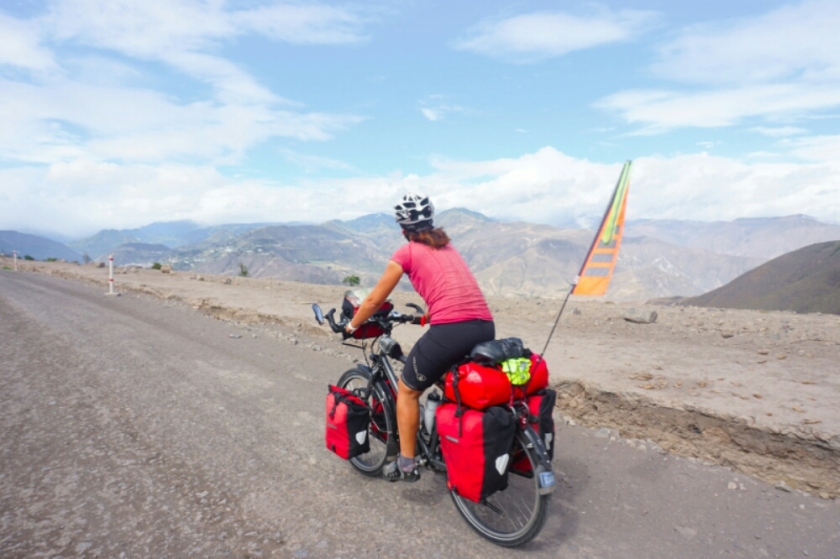
La Noche Buena (Christmas Eve) I spent in Rodeo, with the two lovely owners of the place called Clandestino and Arved, a german traveller. We went out for dinner at a fancy place with good food and a dancefloor out of sand. On Christmas morning I had a relaxed breakfast with fresh bread before I went on cycling.

image

image

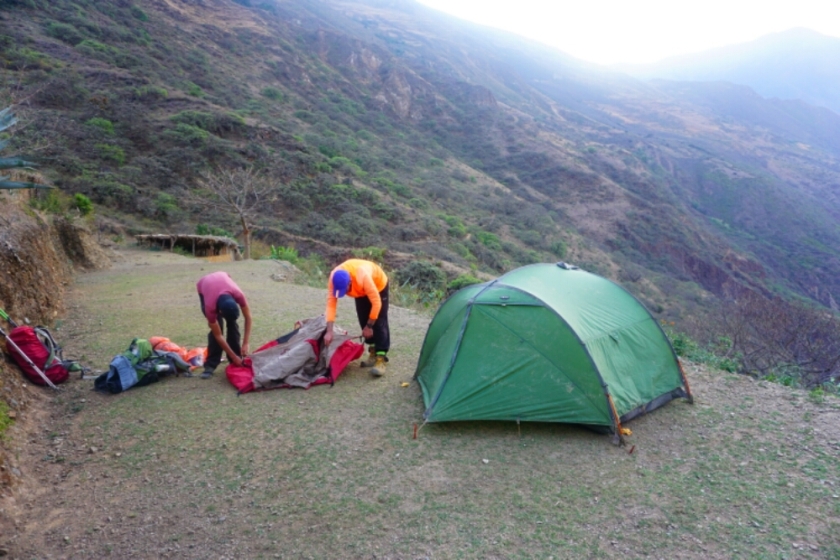
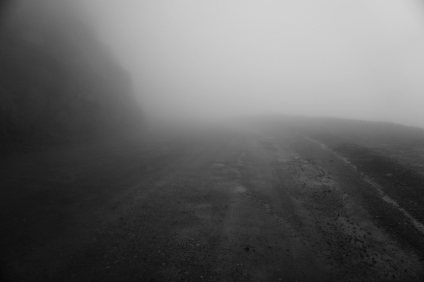
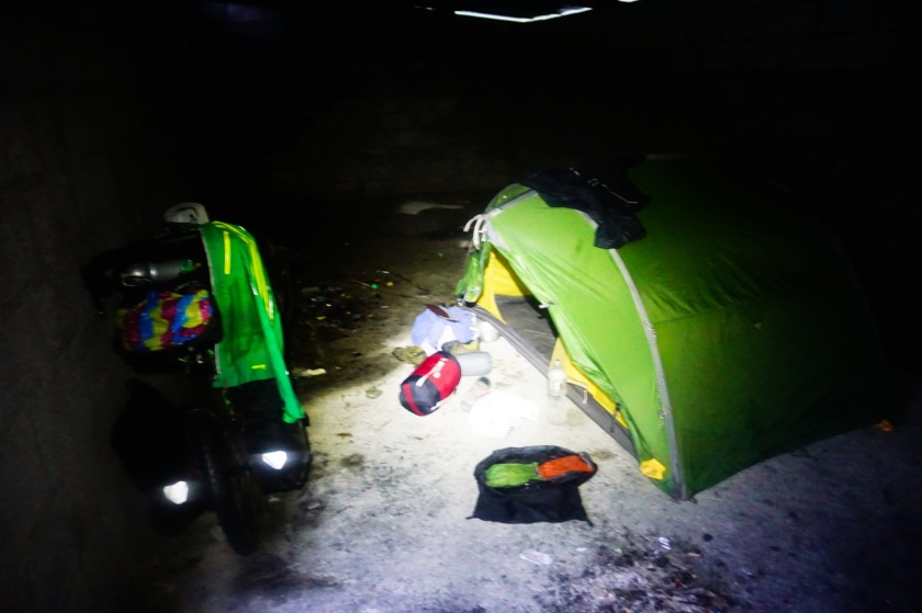
Another Andes crossing, this time from around 1500m to the top of the pass Aqua Negra , 4735m. The first day I met wild horses and camped on 2700 meters. Me and my tent survived a hail thunderstorm, which was going down on on my little housing with an unbelivable loud noise.

image

image

image

The next day I just cycled half a day to camp on 3900m, where it was cold, but not as cold as it would have been near the top.

image

The highlight of the crossing arose during my third cyling day. It was amazing: ice and snow and magnific mountains surrounded me and when I crossed the top, the chilian side was even more beautiful. I was totally flashed by the beauty and when it became time to set up my tent I arrived at a lagune, where I found the best camping spot of my whole travel.

image

image

image

image

image

image

image

image

image

image

image

image

image

image

image

image

image

image

I arrived in Rodeo, where I visited a Observatory  learned a lot about all the things which are million light years away from us, saw the ISS passing by and for the first time the cross of the south.

image

image

My accommodation in Vicuña was owned by a woman who used to live in Stuttgart nearly 20 years ago. I found a facecloth on my bed and had a german breakfast with Christstollen and a small Rittersport choclate.

image

The world is beautiful

It seemed as if somebody threw some buckets of colours over the mountains in the north of Argentina. Amazing face of the world, unbelivable composition. After some relaxing days in San Pedro de Atacama I found my way to country number 8 on my way down south in Latino America. A lonesome region on high altitude, a dry desert, lagunes and salt lakes, decorated with vicuñas, wild donkeys and Llamas. But this time I could lift my eyes and observe my surroundings more than on the Lagune route in the south of Bolivia, cause this time the road was paved and so my joints and my affected but we’re happy to recover a bit more.

image

From San Pedro I hitchhiked the 2000 meter uphill until the point I came from Bolivia, a truck from Paraguay gave me a lift and so I found my bike inbetween cars, which are transported from Iquique at the coast of Chile to Paraguay. Heaps of these trucks drive this 2000 kilometers way several times a month.

image

So I was on 4600 meters of altitude again to start my way through the desert on the so called ruta del desierto. The wind was already there but this time it was pushing me into the land. Due to the advanced day I searched a shelter after a few kilometers in this impressive landscape, which appeared to be like in the mars or moon. Next to a lagune with some ducks a found a small wall which served as a shelter. The night was bitter cold, so that my water in the bottles were totally frozen and I also felt a bit cold for the first time on my travel.

image

On day 2 the landscape presented me rock constellation, more lagunes and after I arrived the highest point of Paso Jama on over 4800m it started to go down. Finally I arrived Argentina and although officers at the border worked slowly like rusty trains, everything went without any problems. Looking on a map I realized that I had wrong distance kilometers in my mind and so I augmented the daily kilometers to reach Purmamarca within 4 days. At the Laguna Ana I found an old bus behind a small hill. I felt like in „into the wild“ and also the interior was not as comfortable as in movie I decided to camp inside this rusty vehicle.

image

image

image

image

image

The first little village I arrived was Susques. A calm place were I could by some fruits and chocolate to get some power for the next kilometres. I went up some hundred meters before I went down a beautiful valley with cactuses and weird rock formations. It felt like in the wild west. Some kilometers further the valley opened for the great plain with the Salinas Grandes. But before I entered it, I set up my tent next to an abandoned house. From there I could observe a rising thunderstorm, which arose to an enormous spectacle during the night, the beautiful ceiling full of stars with a play of lightnings  at the horizon in the distance.

image

image

image

image

image

image

Through the plain to the Salinas Grandes and up another 700 meters to the top of the last big mountain, I had my first lunch in Argentina: A small empanada de queso, humanitas  and for dessert goat cheese with cane honey. The last ascent was quite tiring but the way down on the other side a real pleasure. The next valley was amazing. First of all the canyon and more cactuses. And at the end, the colourful mountains round me. Blue, red, white, orange, black, I couldn’t stop to marvel.

image

image

image

image

image

image

image

Finally I arrived Purmamarca. The evening I spent with a guy from Buenas Aires, we had some beer, shared a pizza before we had a red wine from Mendoza with some cheese back in the hostal. The next morning I had a walk inside thesencolourful mountains.

image

When I went down to San Salvador de Jujuy, the landscape changed a lot. More and more plants transformed the natur into a green forest, it became more humid and more clouds covered the ceiling.

Sand, Salt, Rocks and Wind

San Pedro, a oasis in many regards after a week of tough cycling in the South of Bolivia. The famous route of the Lagunes on an average altitude of 4300 meters, without many possibilities of food and water supply, heaps of climbing, lots of strong winds, cold nights, intense sun, dry air and paths covered with sand and rocks. It was definitely the hardest section of my way down south so far. BUT, it was so worth it! Every single day the landscape gave me new energy! But let’s start in Oruro, where I met Sam again to take the train to Uyuni!

It was a beautiful travel trough on the flat altiplano. We saw a thousands of flamencos in the huge lake of Poopo, before the sunset atmosphere encased us with a wonderful play of colours.

image

image

image

A interesting spot in Uyuni were the old trains whose shapes out of steel rust in the surrounding sand and create an special atmosphere especially during the light of a further sunset.

image

image

image

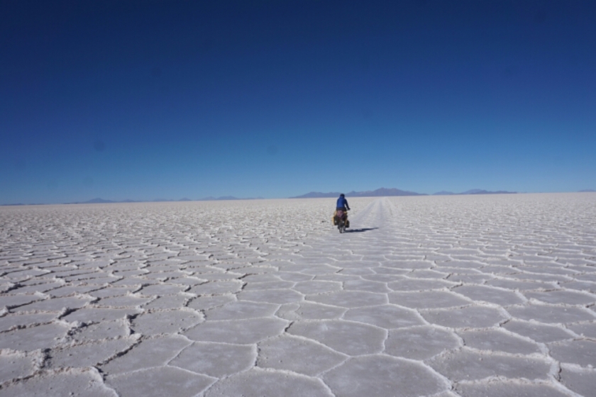
We left to the Salar de Uyuni where we camped in the middle of nowhere on this huge white field of salt. It was very windy, so that we had to wait for the sunset again to put up our tents afterwards, when the wind was subsiding.

image

image

image

image

We left the middle of the Salar, but camped another time on the salt, this time mixed with clay and therefor easier to mount our tents into the ground. In the night a sandstorm swept across our housings but both tents withstood the force of nature.

image

image

image

image

In San Juan Sam decided to go directly to Chile, so I was on my own to proceed towards some days of adventure in the mountains of Bolivia. After some comperative easy kilometers on another plane salt lake I faced the first climb. It was horrible to ride, so that I had to push my bike several times. I first glimpse on what was coming in the next few days. I imagined to arrive at the short section of the main road but I ended up settle down for the night a few kilometers before.

image

image

The second day I arrived at the first lake, Laguna Cañapa, where I observed the birds, flamencos and seagulls, before I cooked myself some mashed potatoes.

image

image

image

image

For the night I arrived at the Laguna Hediondo where I asked to camp next to the Ecolodge de Los Flamingos. But instead I was offered to stay inside. They even provided me water and breakfast for free. Very nice people, so that I gave them my beani as a present when I left in the next morning.

image

image

image

image

On my further way I saw another cyclist in the distance nd when I got closer I saw that it was Camille, a friend I’ve been hiking with near Cusco. He had a problem with its pedal, but first we cycled together and found a nice shelter to camp in the evening.

image

image

image

To get out of the tent in the morning some motivation was always needed, cause the temperature at night and in theearly hours wasn’t that comfortable. During the day I passed some rock formations, one of the the árbol de piedras, a rock which looked like a tree.

image

image

image

The way down to the laguna Colorada was very hard to ride, the destination close but it seemed not to get closer. But finally I was next to the lake, where the national park „Reserva National de Fauna Anadina Eduardo Avaroa“ started. Inbetween the day the Camille had further problems with its pedal, so that he arrived after me with one of the numerous trucks, which drove around the tourists.

image

image

The pedal was fixed, welded by a mechanic and this in the middle of nowhere. After a night in the Refugio we started together, but after 10 kilometers the pedal brake again. So we had a last lunch together, before I went on climbing up the highest section of the Lagune route, while Camille went back to his mechanic.

image

image

image

image

image

After another tough drive I arrived the geyser field. Steam was coming out of the earth and was blown away by a strong wind. Behind an abandoned house I set up my tent, with 4880 meters the highest point I ever camped on.

image

image

The highest point I ever ride my bike followed the next morning, 4926 meters. After I reached the pass it went down to the Lagune de Chalviri, where a thermal bath waited for me. I directly rode my bike next to it and jumped in to relax. Two hours long I enjoyed the comfortable water and the nice view onto the Lagune.

image

image

It was still early and so I decided to go on to the next highlight, the laguna verde and the laguna blanca. After another climb with headwind it went down again. Due to some sandy parts I was more sliding than riding down my bike. And when I arrived I was happy again to have found a nice spot to camp with a beautiful view over the Laguna Blanca.

image

image

image

image

image

The Laguna Verde was just 2 kilometers away from my sleeping spot and at the time I arrived the outlook full of people. Some of them coriously started to ask me questions, below them as well other cyclists. And so again I felt like a wild animal or an mascot with whom you take fotos with. But the people were all friendly and took a foto of me.

image

image

image

The last day in the south of Bolivia, heading to Chile and San Pedro de Atacama was less easy to ride. The wind already woke up in the morning and my imagination about the last pass was much more relaxed. On top my legs were quite tired after the last 6 days. The border was no problem again and finally I was on a paved street again. 2000 meters downhill sounded on tarmac sounded like a dream, but another strong head wind significantly prolonged the time to arrive in the Oasis of San Pedro de Atacama!

image

image

image

Finally I arrived back in the civilisation, with all culinary amenities and a hot shower. It was a great ride and great motivation to do similar treks, apart from the main roads with significant sceneries around!

On the glacier of Huayna Potosí

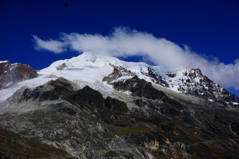
After the volcano Cotopaxi in Ecuador, where David and I climbed to 5600 meters of altitude, it was time to start my second try to exceed the magic number of 6000 meters! Huayna Potosí with 6088m of altitude it just 30km away from La Paz and the ascent shouldn’t be that technical. But what I learned from the Cotopaxi experience was

After the volcano Cotopaxi (5897m) in Ecuador, where David and I climbed until a height of around 5600 meters of altitude, it was time to start my second try to exceed the magic number of 6000 meters! Huayna Potosí with 6088m of altitude it just 30km away from La Paz and the ascent shouldn’t be that technical. But what I learned from the Cotopaxi experience was that my body needs more time to get used to the altitude. Although I had no major problems on the glacier in Ecuador, I was close to the inner border of my physical fitness. Furthermore it was the first experience for Sam on that height and so we decided to climb step by step to give our bodies time. Another thing I learned was to have a close look on the equipment before booking a tour and so we spent over an hour in the tour agency and tried on pants, shoes, helmets, jackets, crampons and so on! The equipment was not brandnew and some parts were not in the best condition, but nothing what would impair our safety or comfort. And so we booked a 3 day tour and bought ahead the necessary things for the ascent.

image

DAY 1:
In the Casa de Ciclistas in La Paz we were on an altitude of 3500m. The days before next to the lake Titikaka we were always between 3800m and 4350m, so the first aclimatization step was already accomplished. Because of a strike of the buses in the city, which blocked the streets in the whole city, we had to leave very early to leave the city. With the taxi the agency collected us from our accommodation and at their office we switched into a van to leave the city. On our way we heard that another group, who tried to leave later, was not able to get out of the center, so we were lucky. After leaving the city boundaries we went on a dirt road into the mountains towards the first refuge on 4750m. We were welcomed by a indigenous lady of the Amayram tribe. I was still quite tired and we still had time and so I first took a two hours nap in our shelter. Well rested we had lunch with a tasty vegetable soup and for me a vegetarian main dish with rice, egg, french fries and salad while Sam was having chicken instead of the egg. I was suprised that I was asked in the tour office about being a vegetarian – very considerate!
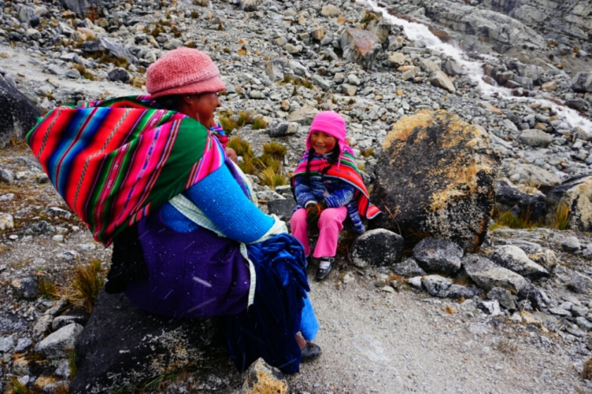
After the strengthening we accompanied by our host woman and her child to a nearby glacier where we met Adrian, our guide, who gave us a first briefing how to use the equipment. On our way we were walking to the clouds of a thunderstorm. The noise of the thunder was reechoing in the mountains and generated a mighty atmosphere. We arrived the glacier and got to know Adrian. The first few introductions where easy to learn and viable, the second part was new to me and more challenging. Sam and me had to learn how to overcome the steep face out of ice and subsequently a vertical ice wall. And although we will not face a vertical wall on our way to the top, we were happy to have gained that experience. After that lesson we went back to the refuge were we had an extensive meal in the afternoon and plenty of time to relax.

image

image

image

image

image

DAY 2:
We got up at around 7:30 and had an extensive breakfast. Before  ascending to the second refuge on 5130m, we explored the surroundings of the first refuge cause there were still some more time left. For the water supply they constructed a canal from a upper lake, which is filled by glaciers. Furthermore the use all the glacier water to produce energy, so huge power grid transport the energy to La Paz and El Alto.

image

image

image

image

At 10 a.m. we left, the weather was good, some sun and some clouds took turns. The equipment for the glacier in our backpack, as well as some food and the sleeping bag, we had to carry around 15 kilos up the mountain. The way was good to walk, the altitude bounded the speed but after two hours we arrived in Campo Alto! The day ended by playing the card games ‚Rikiki‘ and ‚Belotte ‚which were teached by group of belgium travellers. The atmosphere was very good under all the groups who wanted to climb to the top! At 7 o’clock everybody went to bed to gain energy for the next day.

image

image

DAY 3:
At midnight a guide entered the bedroom by making the noise „bru bru bru“ to imitate an alarm and one by one everybody went on their feet! Somebody was playing a song on their cell phone and suddenly everybody were tapping in the rhythm of the song. It seemed as if everybody were excited to go up.
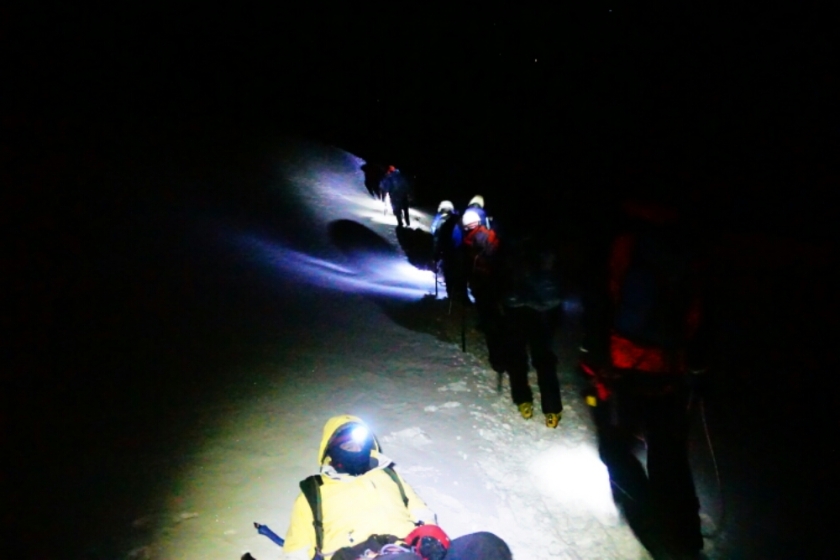
Sam and me were informed that we will have another guide for the ascent. Juan seemed to be a little tired at the beginning, cause he first forgot to get on his crampons and after he put them on, he left his gloves in the snow. Good start, I thought, but no further similar incidents happend. The way up was again taking ages – step by step we were walking up. In the dark the world of ice and snow around us as well as deep holes and slopes were not visible. Only the lights of the other groups and the alighted feet of Sam and the snow in front of me were able to be seen.

image

Steep parts and nearly plane parts alternated. After around 4 hours we were going up on a steep ridge of maybe one and a half meters wide, where on both sides it was going down into the darkness. Leaving that behind it became to get lighter – the sunrise was getting closer until we could turn off our headlamps.

image

image

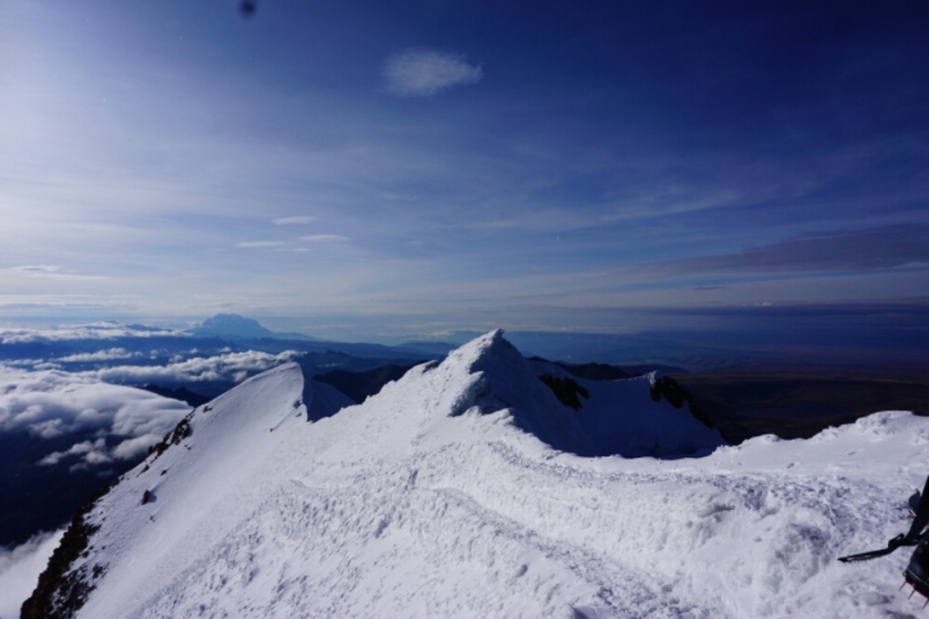
The last part of the path was possible to see and with it the steepness of the last few meters to the top. Some groups were already inside that part, struggling to go up. Other groups already turned around and I also had my problems. I had to fight against a rising headache and while we had a break I was getting tired. The guide already asked if we should turn around but we were close and so Sam and me mobilized our last energy. The steepest part at the end was demanding everything of our endurance and concentration and I was again at a point to give up.
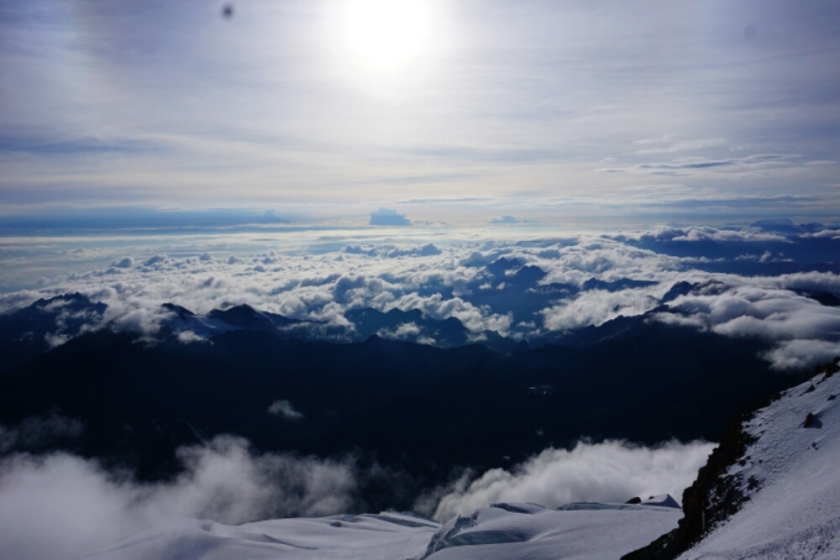
When I was finally reaching the top, I was so touched by the view and by the fact that I had really reached the top of Huayna Potosí, which is an insane 6088 meters high.

image

image

image

image

image

image

We enjoyed the view for some minutes, but due to the rising temperatures we had to start the way back to the refuge. After 6 hours of such a hard climb we still had to stay concentrated for the descent and it appeared to become a very challenging way down cause due the sun the ice was starting to melt. This fact entailed that the crampons were full of snow and so the grip was getting less. Now we were able to see all the beautiful forms of the glacier, but also the steep slopes directly besides us. Reaching the ridge, the situation was extremely dangerous. We went down very slowly, removing the slippery snow underneath the crampons nearly every step. After another 3 hours we were happy to reach the Refugio. Here we had one hour to rest before we went down another 1 1/2 hours to the second refuge were the car to la Paz was already waiting.

image

image

image

image

image

It was another amazing experience, but I guess I wouldn’t do it again. The view from the top is mind-blowing, but it does also demand everything of yourself, it’s definitely not healthy and also not without a risk!

Chance of a better future

I was sitting in a kind of big classroom, when suddenly a young peruvian girl was coming up to me to give me a hug! I was overwhelmed by this cordially gesture and said to myself that all people on the world should have the same possibilities to develop in life!

image

Two weeks ago I visited the German development project „Kinderhilfe Cusco“ in Quiquijana, a small village 70 kilometers in the south of Cusco. I arrived at the „Albergue“ in the evening and received a warm welcome by the volunteers and the nuns. The time was an interesting experience for me. Helping children with their homework, teaching them english, playing soccer with them and get to know their backgrounds moved me and offered me a good variation in my current cycling life.

image

image

image

image

image

I spent three nights at that place to gain an impression about the work of the volunteers and the project as a whole. The project Kinderhilfe Cusco – Peru e.V. started in 1989 by supporting a lunch table in Cusco and from 2001 on a second one in Quiquijana. Cause of a missing infrastructure this involvement led to the construction of a youth center, which was opened in 2008. Besides offering a place to stay for up to 100 children, it’s a place for social and pedagogical education.

image

image

The main goal of the project is to fight the poverty and to help to improve the education and food situation. Over the years further support grew in the area of Cusco.
The children in Quiquijana come from tough family backgrounds, live in poor conditions and some of them wouldn’t even have the possibility to attend school, cause their homes are to far away to go this long way two times a day.
In the „Albergue“ in Quiquijana 6 volunteers work for one year to support one local teacher, a cook and three nuns of the sisterhood „Siervas de Christo Sacerdote“. The 4 girls and 2 boys just finished school and most of them found the project over weltwärts. They had a prepartion seminar as well as six weeks of a spanish language course in advance. Furthermore the local teacher seems to have a lot of experience and a good apprenticeship and therefor can support the young and motivated volunteers. This combination make sure that the children get a good support. Besides the time with the children, the daily schedule includes some hours of work in a nearby farm in the morning.

image

In two greenhouses vegetables are grown to supplement the daily meals for the children. A third greenhouse is in construction to plant roses, which will be sold to gain money for the  facility.

image

image

image

More information you will find on the official page of the german development project.

So, why do I think this project is worth to support? For me some things are important to declare it a helpful and meaningful project:
– collaboration: decisions are taken together, the local people together with the donor
– local support: investments involve local enterprises, so that the money support the economic development of the region
– transparency: the use of the donations is transparent for members and supporters of the projects
– sustainability: to act in a sustainable way, help to self-help

In all of this topics the Kinderhilfe Cusco is doing very well and I was impressed by the effort of the founder Dr. Heinz Gravenkötter and the volunteers.

If you have any further questions about my experiences about this development projects, feel free to ask!
Three of the current volunteers share their experiences on their blogs, which will give you another insight about their work and the project jn general:
sarahserlebnisseinperu.jimdo.de (Blog of Sarah)
einjahrinperu.jimdo.com (Blog of Ronja and Leander)

image

Choquequirao

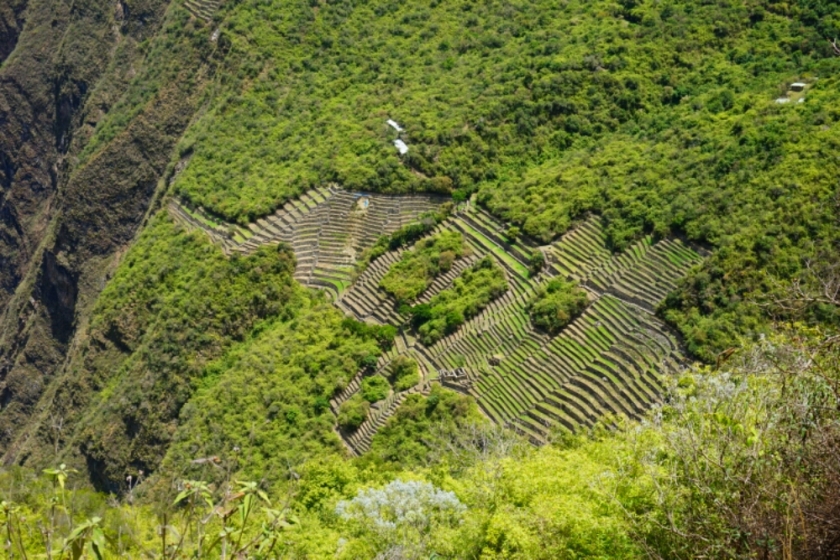
Choquequirao, the small sister of Machu Picchu, doesn’t get so much tourist attention, indeed there were only 3 more persons around us when we visited the place. So it felt, as if we had the ruins on our own. No officers who tell you were you are allowed to go ( in Machu Picchu there are plenty of them), rathermore a pleasant silence without a mass of tourists. Choquequirao was also one of the last bastions of resistance and refuge of the Inkas and therefore an important historical place.

image

I’ve already left Cusco to stay to nights in Quiquijana, 70 kilometers in the south of the city, when Vincent, a Canadian cyclist ask to join him to do a trek. And so I left my bike in this little village to return to Cusco. The bus took two hours and just cost 5 soles. Of course I took the chance to have another meal  in „Green Point“, the vegan restaurant with the amazing lunch offer. There I met Vincent and Camille, a french cyclist, who were also in to do a trek. We had to choose between Ausangate, Choquequirao and a tour into the jungle. Before I received the recommendation from a local to do the hike of Choquequirao and it was also the easiest considering the organization, so the decision was taken.

We left Cusco very early at around 5 a.m. to start the hike from Cachora in the late morning. The weather was beautiful, maybe to good, because the heat of the sun made the hard trek of Choquequirao not easier. After a just a few kilometers and the first descents, Vincent figured out that the rented shoes had a metal thing in the front, which let him suffer while going down. This escorted him half of our tour and we had to slow down to made it endurable for him. And after a rather flat part it was going down the rest of our first day. Still not crossed the Apurimac river we found a beautiful campsite to put up our tents. The view was breathtaking, the sunset behind the mountains opened up a colourful sky followed by the bright shining stars!

image

image

image

image

image

image

image

image

image

image

image

The next day we reached the river, the sun was burning down on us, which made the climb on the other side of the river a big challenge. 1500 meters uphill. We had to break several times but we were willing to reach the campsite close to Choquequirao to discover the place in the morning. On our last kilometers, we met two other cyclists, one of them carrying a second pair of shoes with him – the salvation for Vincent you suffered a lot under his bad shoes. The place to camp was another time blessed with an amazing view into the valley, so that Camille and me enjoyed taking pictures again.

image

image

image

image

Day 3, climbing up the last few hundred meters to Choquequirao. Still tired of the last day we were dragging ourselves through the ruins inbetween which we had to overcome some other ascents and descents. But it was worth all the way. Nearly alone on that hill we discovered the remains of the culture of the Inkas. After some hours we started our way back, which started with a long way down back to the river! This time Vincent was much faster, so that we reached our last campsite of the trek early. Totally tired we cooked and watched the stars again. The temperatures in the evening were just perfect, but the Mosquitos were not our friends during all the days.

image

image

image

image

The last day we had to go up another 1500 meters again, but we arrived early on the top and catched a taxi, who took us back into direction Cusco.
A beautiful, but also a hard trek to visit Choquequirao!

Here are some facts about how to get there from Cusco: there is a bus station in the street Arcopata, which is in the north of the historical center, Here small buses leave from 5 o’clock in the morning to Curahuasi (15 Soles and about 1:45 hours of driving). From Curahuasi you can take another small bus or a taxi to Cachora (15 Soles and about 45 minutes). In Cachora there is the possibility to go to close to the Mirador de Capuliyoc to save about 10 kilometers of the trek. For the way back the prices are the same.

La bonita ciuadad de Cusco y las ruinas de Machu Picchu

After 5 days in Cusco, including the trip to Machu Picchu, I spent my last hours hours in the vegan Restaurant „Green Point“ to write. The restaurant does not just provide healthy, ecological and vegan food, but offers an pleasant atmosphere. But the best is the lunch offer for just 12 Soles,  which does include a salad from a buffet, a soup, a main course, a dessert and a frech juice. For the main course there are two options, between you can choose. Currently I’m just having a coffee while listening to the music of Vintage Reggae Café.

image

image

Cusco entered the charts of my top cities in Latino America on number one. Cuenca y Cartagena had a great atmosphere as well, but Cusco had its special charme with numerous culinary and culture offers. The nice market of San Pedro, the neighborhood of San Blas, the narrow streets and the colonial buildings. Additionally there are several treks around to walk in the mountains or to discover the ruins of the Inkas. Cusco in pictures:

image

image

image

image

image

I spent a full day in Cusco, walked around a lot, visited the museum Coricancha, gave away my camera to let it clean, visited the market and bought a new gas cartridge as well as some care products. So I was prepared to go to Machu Picchu the next day. There are several options to visit the city of the Inkas. You can take the service of one of the hundreds tour offices, which is maybe the most expensive possibility. Then you can follow the Inka trail or other treks, which will take several days. Another economical way and that’s what I have done, is the public transport, which I will sum up shortly.

image

The map shows how to get from Cusco to Machu Picchu. At first you can take a bus for 15 Soles into direction Qillabamba and leave the bus at Santa Maria. To get there, the bus needs around 6 hours. Arrived in Santa Maria further taxis and small buses will wait for you to go go to Santa Teresa (10 soles, 1 hour) or Hidroeléctrica  (15 Soles,  1 1/2 hour). From Hidroeléctrica there is the possibility to take the train (38 $, 15 minutes) or to walk along the rails (2 hours). In Aqua Calientes there are many hostels in all price categories, so no need to reserve in advance. Also restaurants are numerous. If you want to avoid the touristic prices, go to the small market, which is near the Plaza de armas. There you get a meal for 6 soles. Usually  you stay one night in Aqua Caliente after a one day journey to arrive there. In the next morning you can take the bus (12 $, starts from 5:30) or walk (bridge opens at 5:00) up to the entrance of Machu Picchu pueblo (opens at 6:00). It’s a steep walk, but if you hurry up, you will arrive before the first buses.
For the tickets for Machu Picchu you have three possibilities. Machu Picchu Pueblo (128 soles), Machu Picchu Pueblo + Machu Picchu Mountain  (148 soles) and Machu Picchu Pueblo + Wayna Picchu Mountain. The tickets can be purchased in Cusco or near the Plaza de Armas in Aqua Calientes.

So, back to my experiences: I got up early in Aqua Calientes to walk up and arrive for the big mass of tourists and indeed I did it and after I entered the entrance I got to see the ruins without people while the llamas were running over the green areas inside the village. It was an awesome experience when I catched the first glimpse. It’s impressive that human beings were able to construct these houses and walls during that time, considering that it’s high up in the mountain and the stones are quite big and heavy. After I walked to the Inka bridge and walked around a bit, I went up to the mountain of Machu Picchu. I was still exhausted from the first climb and didn’t expect that another 500 meters steep walk up to the top waited for me. The weather at that morning also wasn’t the best, foggy, cold and during my way up I even went into the clouds. On the top I was surrounded by a big white soup of clouds and it took over an hour before I could look down. But after the torture of the climb and the amazing view over the ruins, which finally appeared, it was totally worth to wait for a while.

Waiting for the bridge to open.

image

image

The view, when I arrived on the top of Machu Picchu.

image

image

A part of the ruins were visible.

image

And finally the clouds were gone.

image

image

image

image

image

image

image

image

The street from Aqua Calientes to the entrance of Machu Picchu pueblo.

image

Machu Picchu on our way back to Hydroeléctrica

image

I left Cusco to Quiquijana, a small village 70 kilometers in the south of the city. There it finally worked, what I tried from time to time during my travel. What it is will be found on my blog in the next few days.

Ecuadors South

Descansar – Relax, nothing can be better at the end of a cycling day to calm down. Today I stay in the courtyard of a restaurant/beer garden and I hover in the sound of pleasant latin music. I wanted to feet my blog more often, but didn’t happen. So, let’s summarize the highlights.
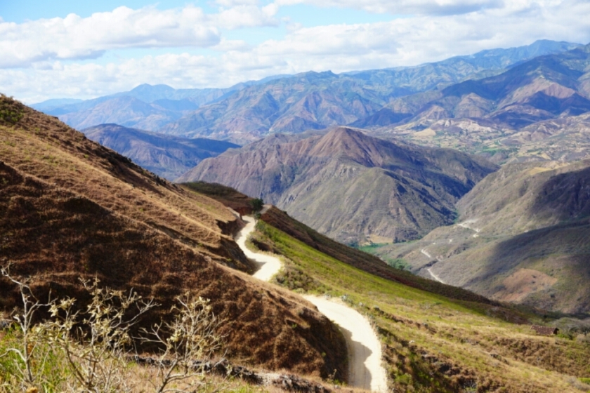
Cuenca to Loya: Three days, three big mountains. It’s strange, cause back at home 1500 meters of going up with my bicycle would have been a hard day after what my muscles would be aching for some days. In the Andes of Ecuador it became normal. Sure, it is not a piece of cake, but I feel to get used to it. And the outlook into the valleys rewarded myself for the up and downs of the streets. On the last stage to Loja, I followed the suggestion of my navigation system komoot and took after the village San Lucas the road along the identically named river. Although it was dirt road, the shortcut was worth it.

image

image

image

image

image

image

image

image

Loja: Cochsurfing or Warmshowers in Ecuador didn’t n seem to be an easy thing, 6 requests and one answer. The couchsurfer offered me to ask a friend, where I could spent the night. I called the friend, as agreed, waited in the park, wrote him again, but he never showed up or answered. On the day I left Loja, I demolished a door out of glas in the cheap hotel I stayed in. Furthermore my heavy bike lost its balance and crashed into the neighbour’s door. After that I felt a bit like a villain, cause they treated me like I did it on purpose. After visiting a nearby workshop I paid 3 times more than the actual stay! On top it rained while leaving Loja. So I guess I won’t come back to this place.

image

image

Vilcabamba: So many travellers, I met on my way, told me to visit this little village in the south of Loja. After a short climb, it was going down until Malacatos to crest another hill. In the valley Vilcabamba appeared and surrounded by a beautiful scenery it was really worth to see it. But principally it were the people who make my stay, what it was. Some kilometers from the village I stayed in the garden of a American woman, who have chosen this quit place, to built up her new life. I was not the only guest, a columbian couple and an awesome guy from the states also spent some time at her place. The next day we went to a traditional sweat in the meditation center. Pouring water on glowing hot stones heated up the air and rose the humidity. The guide who leaded us trough the evening was singing songs and praying in a native language. This experience didn’t just feel good, with the procedure it was definitely a highlight of my stay.

image

image

image

image

Vilcabamba to Macará: Instead of going back to my favourite town Loja and taking the Panamericana, I decided to ride my bike over Gonzanamá to the Peruvian border. 90% of the road is dirt road and before heading to the coast in Peru the Andes show again, that it miss the word „flat“ in their dictionary. And on top there doesn’t exist sufficient word to describe the landscape.

image

image

image

Near the border to Peru, the Ecuadorians produce a lot of bricks of loam to built their houses. Therefor they put mud in mold, dry it and finally heat it up in an oven, which is also made out of loam bricks.

image

Besides the bricks they crow corn, which they dry next to their houses.

image

I nearly had a flat tyre in Ecuador and was looking forward to write „puncture – free Ecuador“, but on my two last days I had to patch my tube twice. However, it’s way better than at the beginning. 

image

Over the low clouds I rode the last part and finally down to the border to Peru.

image

image

image

To leave the country I had to fill out a sheet of paper with the usual information. A long cue but just one clerk let this procedure take a while. But finally I could cross the bridge to Peru, where the formalities of the entry took place.

image

La selva, Andes crossing, Cuenca and the Toreadora Hike

To adjust to the attention span of nowadays and to spent less time with writing, I intend to write shorter but more frequently blog entries. But here I will some up the the highlights of the last few days.

Ecuador can be split in three parts going from north to south related to the different climatic conditions: the warm and rather dry area at the coast, the mountains and the amazonian area with the jungle (la selva).
After we spent most of the time in the mountains of Ecuador, we went down to the amazonian area. After we passed heaps of nice waterfalls on the way down to Puyo, we had to deal with a lot of rain.

image

Near Tena we stayed at a Couchsurfer, which we nearly haven’t seen. Instead we encountered around 15 volunteers on his eco farm, who ran the daily business. At the same time it was a spiritual place with vegetarian and most of the time vegan food. A certain time schedule including Yoga, some hours of work and a lesson to learn something from the others gave the community their certain framework. The food, usually made by someone else, was most of the time very delicious and on the day we arrived we enjoyed self made chocolate from the Cacao plants of the farm.

image

image

image

image

image

image

Some musicians, some volunteers and the owner spontaneously organized a festival in town with artists from all over the continent, some of them travellers, who just dropped in on the stage.

image

image

image

Due to an infection of Tobias, we stayed one more day in Puyo, so that he could recover, but the sickness returned again one week later and leaded to a visit to the doctor, who prescribed him Antibiotika. Consequently Tobias needed more days of recovering and took the bus to Cuenca while I crossed the Andes alone. Accompanied by rain and fog I started into the climb. After an hour I arrived at the junction to the street in the mountains, where I got warned of a landslide. „Senior, Derrumbe en la vía, no es possible de pasar!“ „Con bici tampoco?“ „Bla bla bla..bla.“ „Es possible de pasar con bici, Si o No?“ „Si“. Well, I think he got as much from me as I understood him. The street upwards seemed to be very calm. Hardly a car, which overtook me and not one car which came towards me. No car? Yes, but I first realized as I bumped into a traffic jam. With the bike no problem to pass by. The first landslide appeared to be possible to pass somehow and so I checked my possibilities under the eyes of around 30 Ecuadorians who left their vehicles to watch the clearing work. It started to rain again and before everybody escaped into their warm and dry places in the bus or car, I found two guys who helped me overcome this muddy obstacle. Just arrived on the other side, the road got totally muddy, followed by another queue of vehicles. A huge ongoing landslide seemed to make a getting through impossible. I collected myself an invitation to sit in the bus, while my bike had to endure the ongoing rain. But it didn’t take long, I was back outside to do what had to be done. Slowly and carefully I pushed my bike through the mud and the last few meters trough the sliding mass of the brown viscous water. Under the cheering of the waiting cars, trucks and buses a went on with my ride to come closer to the top. After a big portion of lunch, how can it be different the next landslide. My shoes already totally covered by mud I heaved my heavy bike to this rather small landslide. The weather didn’t become better, more dense Haze,  more rain and falling temperatures. The top still 600m above me, I passed a house, which seemed to be one of a few possibilities to check in to spent the night.

image

image

image

image

image

In the next morning the weather conditions were still the same and my shoes as wet as the day before. No other suitable shoes for replacement I had to slip again into the lumps of wet mud. After a few kilometers the top was finally reached, but during the descent to Cuenca the airflow let my feet transform into ice cubes.
Arrived in the hostel, totally alive and so happy about a warm shower I knew that it was exactly the kind of experiences which is worth the travel.

Cuenca is probably the most beautiful city in Ecuador. With its pleasant atmosphere, beautiful architecture from colonial times,  vivid culture and a river which flows trough the town it offer a ice place to regain energy for further adventures.

image

image

image

image

After one day of discovering the city, I took a bus to the nearby national park El Cajas to do the Toreadora hike on around 4000m of altitude. I didn’t checked the level of difficulty of the offered tracks and took by accident one of the most challenging ones. At the same time it was maybe also one of the most beautiful with a wonderful outlook from the top of Cerro San Luis. In the night I was the only guest in the refuge, a quite but also very cold place.

image

image

image

image

Trough the mountains of Ecuador

At the place of the Casta Restaurant and a beautiful view on the white summit of Chimborazo I will let you know what happened during my first days in Ecuador besides the experience of hiking Cotopaxi.

image

After we visited the beautiful church in Las Lajas, we had to cross the border to Ecuador. We were still in a group of 4, Tobias, David and Joanne and me. The last view kilometres in Colombia offered us another breattaking landscape. The border-crossing itself was really easy going and with some loud music playing outside the immigration building, it felt like a celebration.

image

image

The first town in Equador was Tulcán, not the most beautiful place, but still worth a visit due to the cemetery. First of all, all cemeteries in Latin America I’ve seen so far are totally different from the ones we have in Germany. They show a more friendly face and white is the dominant colour. Heaps of fresh flowers express, that the church is a big topic for the latin people. The cemetery in Tulcán is outstanding, because the gardeners change the hedges into art.

image

image

image

image

The first night in Ecuador we stayed in a rather expensive hotel in San Gabriel. No hostel was available in the village and due to my birthday Internet connection was demanded. The next day we cycled up and down to the lake of Ibarra. A long part of the street to Ibarra was renewed and closed for transit cars, so we four bikers had it more or less on our own. Most of that part was already done and paved, but downhill we bombed down the gravel road through the road wo works. After we arrived the river, which most of the time indicates the turning point, we had do climb up some hundred meters to arrive at the beautiful lagune, close to Ibarra, where two Germans opened the Finca Sommerwind, a campsite for caravans and tents as well as a german café, which opens during the weekends. Hans and Patricia welcomed us and due to some days with a lot of climbing, we decided to stay one more night at their place. We even got baked a good bread by Patricia, which we enjoyed as well as a barbecue and cooking pasta.

image

image

image

On the road again we passed Otavalo and we’re getting closer to the Equador. And finally behind a corner we crossed the line and entered the southern half of the earth. Two monuments line the streets. One earth – shaped stone, which was built first and is not exactly on the right position, and a sundial, where the non-profit organization Quitsato gave us a very interesting introduction about the place, their work and the alignment of the maps of the world, which they consider to align to the east instead of North,  which became common.

image

image

The last few kilometers to the highest capital on earth on about 2800  meters above the sea level, Quito, was our next destination. With KALARI chocolate in my mouth and music in my ear, I climbed the last ascent to the big urban area. Arrived David and I looked for the Cotopaxi Tour.  Due to the weather forecast we decided to shift the tour by one day, which was the right decision. So the next day was free to discover the old part of Quito, including the highest church in South America, the Basilica de sagrado voto.

image

image

image

image

After the amazing tour to the Cotopaxi, David and Joanne went to Germany for the wedding of David’s Sister. They took some of my stuff to Germany to reduce the weight of my bike – another blog entry about the topic of redundant equipment will follow.
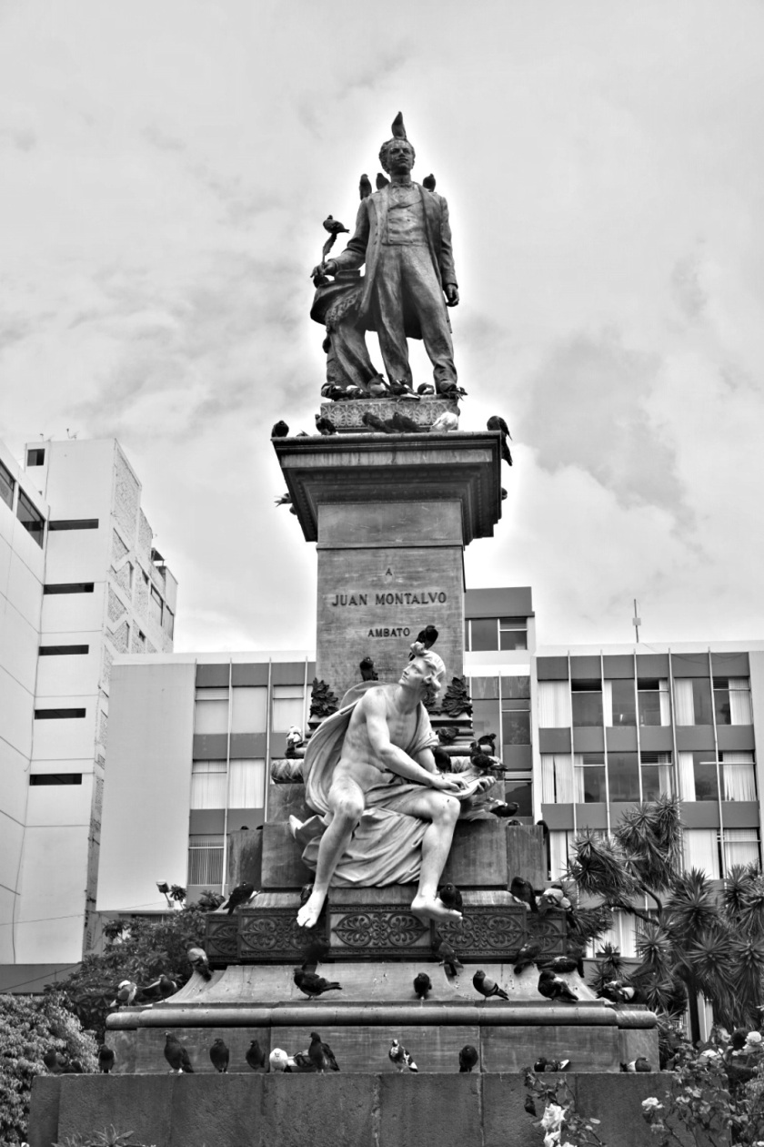
Tobias and I went down further south, riding on the so called street of the volcanos. Two times we camped in gardens of locals, visited the market in Pujilí before we arrived Ambato. In the park we dried our tents before we took part in a tour through the museum of Juan Montalvo, who wrote the national anthem of Ecuador and became one of the most important writers of the country. His thoughts had and still have a great impact of the development of Ecuador. His corpse is kept in a big hall next to the museum.

image

image

image

image

We left our bikes in the inner yard of the restaurant next to the museum, where we met Leo, the owner of the Casa de Ciclistas by accident. He just dropped his daughter at that place and suddenly introduced to us. A real big coincidence! He gave us the direction to his house, where we met again. Leo, who started to offer his place to ciclists some years ago. In 2011 he started a guest book, which was very in testing to have a look at. On top he told us some stories about other cyclists, who stayed at his place. He owns a bike shop, in which we set up our sleeping accomondation. On our departure he gave us a medal as a present, I eternalized in his guest book and schwup, back on the road.

image

image

image

The path over Píllaro to Patate was just wonderful, small little villages, lots of agriculture areas and a nice valley down to Patate, from where it is possible to see the before mentioned two volcanos. Currently we are still waiting for the rain to stop, but it is a nice place with partly annoying music, we listen to since we had breakfast.

image

image

image

image

image

Today we will head to Baños and then down into the amazonian area next to Puyo.